


Red Line Plans Ltd is a high-tech land survey company with strengths in mapping the built environment.
The whole of the UK is covered from a base in Skipton; London, Manchester and Leeds being particularly well served.
Paul Mann is the managing director and chief surveyor of this small business, bringing two decades of hands-on experience to the wide range of work undertaken.
Contact Us
Red Line Plans Ltd
First Floor Office in James Pye Building
12 Newmarket Street
Skipton
BD23 2HR
07957 606548
0844 330 7526
(Lo-Call Rate: 7p/minute from BT land line;
add about 50p network access fee from a mobile)
mail@redlineplans.co.uk
Please be aware that we currently staff the office on a part-time basis. Phone calls and emails are forwarded to Paul's mobile as necessary, and will be answered as reception allows. If you reach an answerphone, please leave a message and we will get back to you. If you include the address of the property concerned we can make initial checks which will allow us to answer your enquiry more precisely and often provide a quote immediately.
Coverage
We cover the whole of the UK from our base in Skipton, North Yorkshire. We serve London, Leeds and Manchester particularly well; but routinely reach Newcastle and Bristol and all places in between.
For the further flung locations our minimum fee is higher, and for locations off the mainland we add the ferry / flight costs to our fees, but for many larger sites we still offer competitive prices. We have visited the towns of Truro, Stranrear and Lowestoft amongst many others in recent times.
Core Staff
Managing Director, Chief Surveyor
Paul studied Geology at St Anne's College, Oxford, worked as an archaeologist for several years where he was quickly deployed to historic buildings (including a stint supervising recording during the redevelopments at Somerset House), and might describe himself as a visio-spatial engineer if such exists. He enjoys getting out on and even into the hills, variously walking, orienteering and caving, (Yes he maps and photographs the caves too).
Director, Business Development
Joanne studied physics at Jesus College, Oxford, and has spent much of her working life in various management support roles in the private health sector. She currently combines this role with one providing employment relations support to dentists. She also enjoys physical challenges offered by adventure racing and caving, but feels no desire to map them.
Vacancies
We currently do not have any vacancies.
We review our staffing needs on a regular basis, but currently predict that no additional staff will be required until 2024 at earliest.
We would consider partnering with an equivalent local surveyor.
Our staffing needs are primarily for skilled CAD technicians with an understanding of building construction, also measured building surveyors, to be based within 30 miles of Skipton. Roles are typically part-time with fair flexibility to accomodate personal needs.
We are happy to accept speculative applicaions in form of CV and covering letter, and will suitable applications on file for up to 12 months.
Company History
The business was founded as Floorplans North in 2003 by Paul Mann. In December 2013 the business became a limited company, and adopted the name Red Line Plans Ltd. This new name better represented our focus on providing high quality maps and plans to support Land Registry submissions, a red line being the typical defining feature of such drawings.
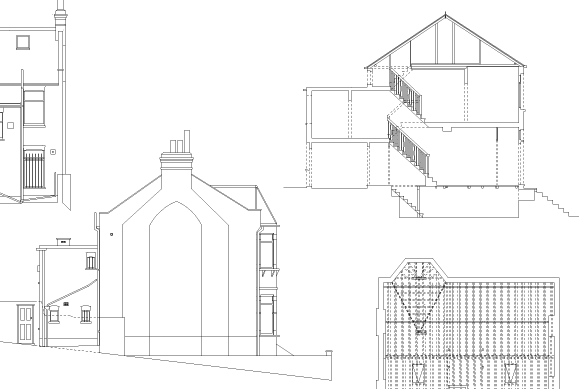
The roots of the business are in providing good quality floor plans to estate agents, however we quickly expanded into providing plans to support licensing applications, sections and elevations to assist building developers, and various other fields where accurate drawings of existing structures are required.
In 2009 Paul Mann began studying a Masters Degree in Geomatics at Glasgow University, with the intent of learning the skills needed to make the most of modern survey technology. Since then the business has invested in total stations and survey grade GPS systems, allowing us to take on more demanding survey projects, and deliver the high quality mapping needed for accurately recording real estate boundaries.
In early 2014 we adopted the ZEB1 handheld mobile laser scanner as our primary tool for most survey work. We were the first business in this sector to adopt this technology, it allows us to produce higher accuracy plans regardless of site complexity, allows us to better predict the time we will require on a site, and offer keener prices particularly on medium and large sized commissions.
In 2023 this system was upgraded to the Revo-RT, providing more reliable and accurate scans quicker at lower cost.
In 2016 we updated our GPS system to a networked system, reducing our time on site for most freehold properties by one hour, and reducing the uncertainty in locations to cm level.